Description:
Highly productive farm located in the bread basket of Dawson County.
Location:
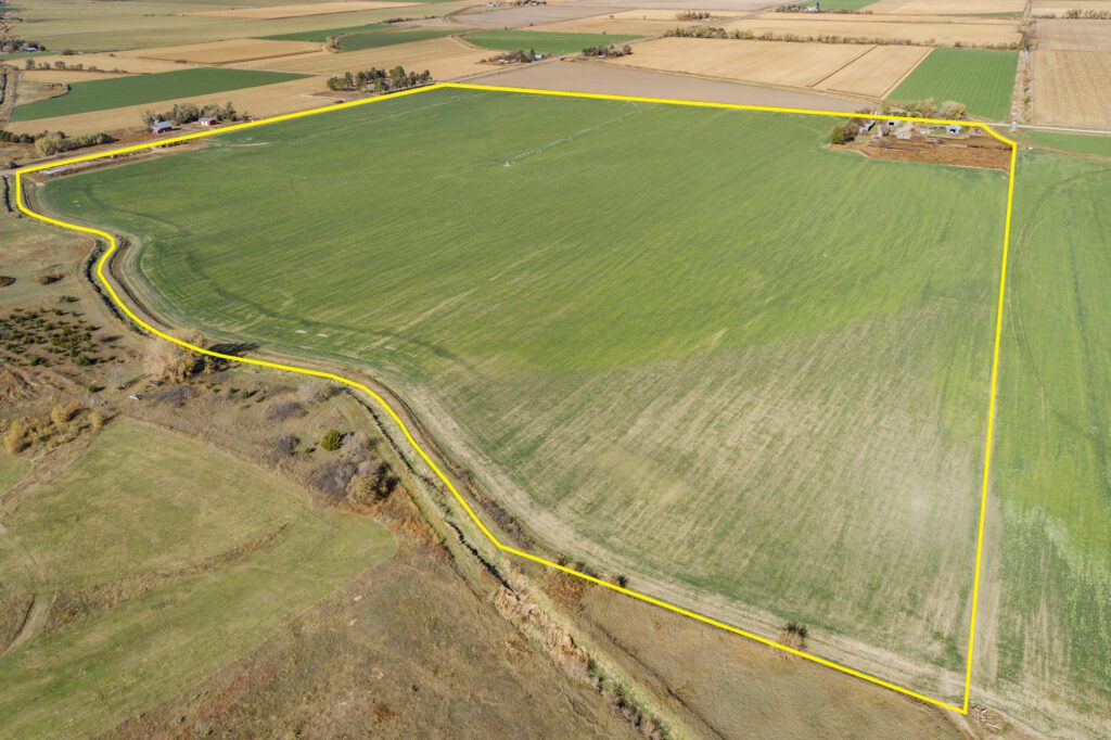
Located 5 miles south of Cozad with access to Parcel #1 provided by State Highway 21, bordering the west, and paved 755 Road, bordering the north.
Legal Description:
Parcel #1 - NW1/4 Section 7, T9N-R23W of the 6th P.M., Dawson County, Nebraska, less tracts.
UNDER CONTRACT Parcel #2 - W1/2 SE1/4 Section 7-T9N-R23W of the 6th P.M., Dawson County, Nebraska.
Farm Service Agency Information:
Parcel #1 – Total Cropland 116.77 acres;
UNDER CONTRACT Parcel #2 – Total Cropland 43.35 acres;
Govt. Base Acres (Both Parcels in Combination):
Corn Base 88.91 acres w/ PLC Yield 189bu/acre
Soybeans 32.99 acres w/ PLC Yield 61bu/acre
UNDER CONTRACT Parcel #2 – Total Cropland 43.35 acres;
Govt. Base Acres (Both Parcels in Combination):
Corn Base 88.91 acres w/ PLC Yield 189bu/acre
Soybeans 32.99 acres w/ PLC Yield 61bu/acre
Irrigation Information:Parcel #1 –
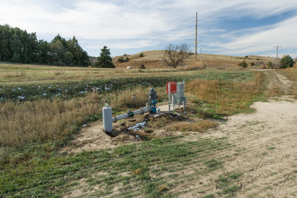
Well Registration: G-122278; Completion Date: 06/12/2003 @ 1,600gpm; Well Depth 200 ft.; Static Water Level 35 ft.; Pumping Level 80 ft.; Column 10 inch; Pump: Goulds
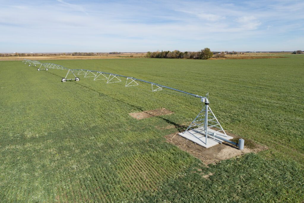
Power is provided by a tenant-owned 60hp electric motor with panel. Water is distributed by a tenant-owned 5-tower Zimmatic pivot with a cornering system. (60hp electric motor, panel, and pivot system do not sell with the property.)
Farm also receives 116.60 acres of surface water rights from the 30-Mile Irrigation District. Parcel #1 is located in the Central Platte Natural Resources District and contains a total of 117.76 certified irrigated acres.
Well Registration: G-122278; Completion Date: 06/12/2003 @ 1,600gpm; Well Depth 200 ft.; Static Water Level 35 ft.; Pumping Level 80 ft.; Column 10 inch; Pump: Goulds
Power is provided by a tenant-owned 60hp electric motor with panel. Water is distributed by a tenant-owned 5-tower Zimmatic pivot with a cornering system. (60hp electric motor, panel, and pivot system do not sell with the property.)
Farm also receives 116.60 acres of surface water rights from the 30-Mile Irrigation District. Parcel #1 is located in the Central Platte Natural Resources District and contains a total of 117.76 certified irrigated acres.
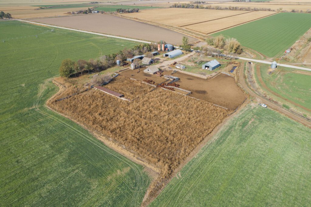
Building Improvements, Parcel #1:3,520 sq. ft. Quonset with full concrete floor
2,400 sq. ft. Behlen building with concrete floor
2,500 sq. ft. pole-frame, open-front equipment building
1,550 sq. ft. pole-frame, open-front equipment building
Chief grain storage bin, equipped with full aeration floor and unloading auger, capacity approx. 25,000 bushels of corn
240 ft. x 60 ft. concrete bunker silo
Soils:
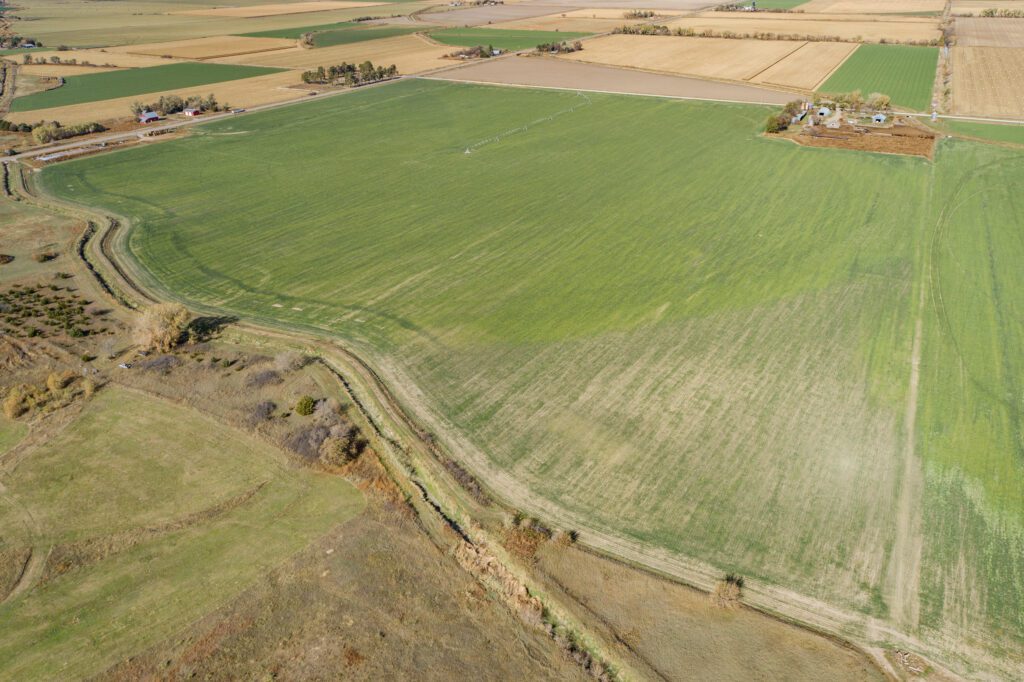
Soils of Parcel #1 consist of Class I and II Cozad silt loams with slopes of 0-3%.
Real Estate Taxes:
Parcel #1 2022 Real Estate Taxes $8,580.74
Comments:
Parcel #1 is a very productive farm with excellent soils and water availability.
Parcel #2 is under contract.
Property Maps
Click thumbnail to open a full size image.