Description:
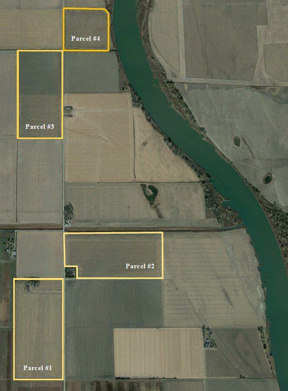
4 parcels of productive Missouri River bottom cropland
Location:
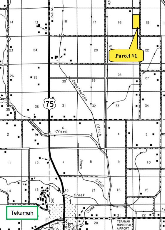
Located in the Missouri River Valley in northeastern Burt County, approximately 8 miles northeast of Tekamah, Nebraska. (Access is provided by county gravel Road 42.)
Legal Description:
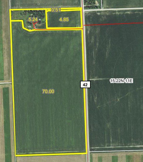
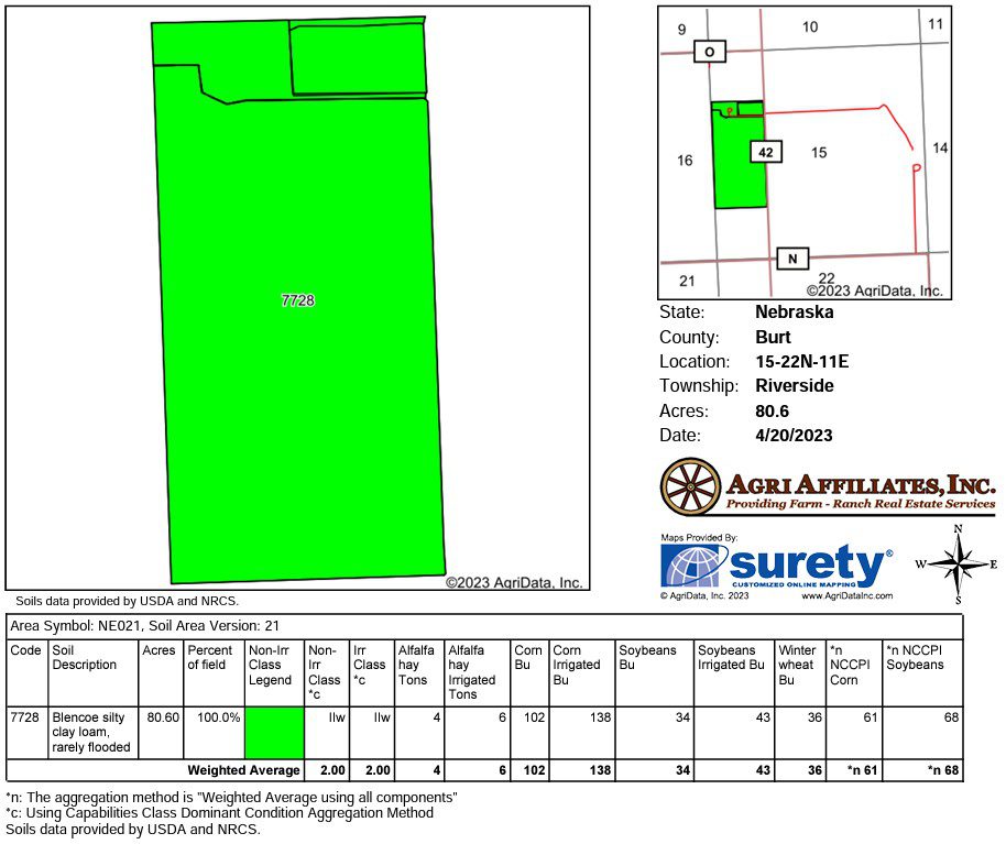
Parcel #1 - SW1/4 NW1/4 and NW1/4 SW1/4 Section 15-T22N-R11E of the 6th P.M., Burt County, Nebraska.
Parcel #2 - NE1/4 NW1/4, except 2.00-acre tract, and NW1/4 NE1/4 Section 15-T22N-R11E of the 6th P.M., Burt County, Nebraska.
Parcel #3 - W1/2 NW1/4 Section 10-T22N-R11E of the 6th P.M., Burt County, Nebraska.
Parcel #4 - SE1/4 SW1/4 Section 3-T22N-R11E of the 6th P.M., Burt County, Nebraska.
Property Description:
Parcel #1 – 80.00 acres of dry cropland with an older improvement site.Parcel #2 – 72.74 acres of dry cropland.
Parcel #3 – 80.00 acres of gravity irrigated cropland.
Parcel #4 – 40.00 acres of gravity irrigated cropland.
Parcel #3 – 80.00 acres of gravity irrigated cropland.
Parcel #4 – 40.00 acres of gravity irrigated cropland.
2022 Taxes:
Parcel #1 and #2 – $9,424.46Parcel #3 – $4,589.66
Parcel #4 – $2,465.46
Parcel #4 – $2,465.46
2022 Drainage Taxes:
Parcels #1 and #2 – $841.50Parcel #3 – $441.16
Parcel #4 – $186.16
Parcel #4 – $186.16
Soils:
Parcel #1 – 100% Class II Blencoe silty clay loam.Parcel #2 – Primarily of Class II Blencoe silty clay loam with lesser amounts of Class I and III Blyburg silt loam and Owego silty clay.
Parcel #3 – Primarily of Class III Forney silty clay with lesser amounts of Class II and III Blencoe and Owego silty clay loams.
Parcel #4 – Primarily of Class II Blencoe silty clay loam with a minor amount of Class III Forney silty clay.
Parcel #3 – Primarily of Class III Forney silty clay with lesser amounts of Class II and III Blencoe and Owego silty clay loams.
Parcel #4 – Primarily of Class II Blencoe silty clay loam with a minor amount of Class III Forney silty clay.
Irrigation Information:
Parcel #3: Well Registration G-00468;Completion Date 4/22/1957 at 1,700 gpm;
Well Depth 112’;
Static Water Level 15’;
Pumping Level 29’;
Column 8”; Pump – Western Land Roller;
Gearhead – Amarillo 100hp;
Diesel motor and irrigation pipe are tenant owned and do not sell with the property.
Well also supplies water via underground pipe to Parcel #4.
Well Depth 112’;
Static Water Level 15’;
Pumping Level 29’;
Column 8”; Pump – Western Land Roller;
Gearhead – Amarillo 100hp;
Diesel motor and irrigation pipe are tenant owned and do not sell with the property.
Well also supplies water via underground pipe to Parcel #4.
Natural Resources District Information:
The farms are located in the Papio-Missouri River Natural Resources District (NRD).
Farm Service Agency Information:
Parcels #1 and #2:
Total Cropland – 147.59 acres;
Government Base Acres – Corn 77.07acres with PLC yield of 177bu/ac;
Soybeans 58.22acres with PLC yield of 34bu/acParcels #3 and #4:
Total Cropland – 115.86 acres;
Government Base Acres – Corn 60.51 ac with PLC yield of 117bu/ac;
Soybeans 45.70ac with PLCyield of 34bu/ac
Comments:
Don’t miss this opportunity to own productive Missouri River bottom cropland.
Property Maps
Click thumbnail to open a full size image.